New Zealand Topo Maps
New Zealand Topographic Maps, Nautical Charts and Aerial Imagery – Offline GPS
Turn your Android phone or tablet into a powerful offline GPS navigation system for New Zealand. Perfect for hiking, cycling, and outdoor activities in areas without mobile coverage.
Explore detailed topographic maps, aerial imagery, nautical charts, and terrain models with advanced navigation tools – similar to professional GPS devices.
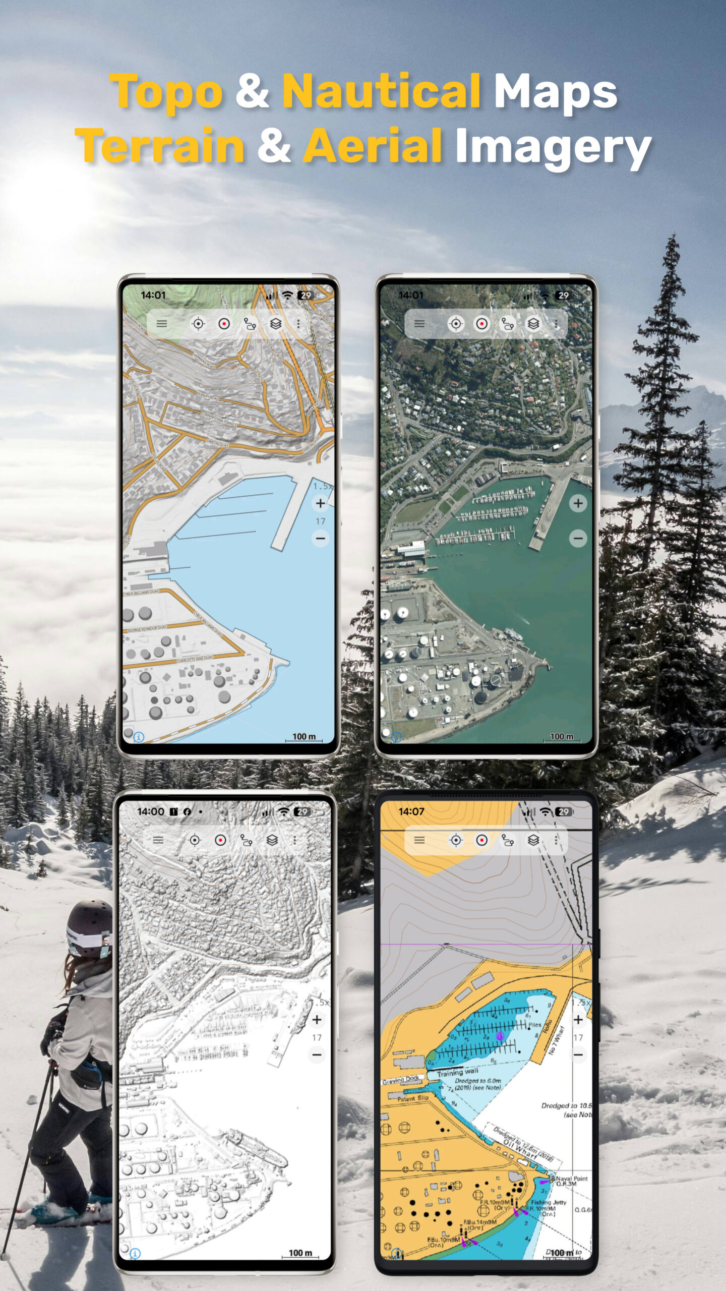
Topographic Maps and Aerial Imagery (Free)
Access high-quality maps for New Zealand and worldwide:
• LINZ 50K & 250K Topo Maps with NZTM2000 Grid – best choice for hiking
• LINZ Topo Basemap LiDAR Hillshade – even more details and high resolution hillshading
• LINZ Aerial Imagery
• LINZ Hillshading (Terrain Model & Surface Model)
• NZ Mariner (RNC Nautical Charts)
• AtloMaps OSM Maps with hillshading (worldwide)
• CyclOSM maps for cycling routes
• ESRI Topographic, Aerial, and Street Maps (online only)
• Google Maps and Satellite (online only)
• Bing Maps and Satellite (online only)
• Earth at Night
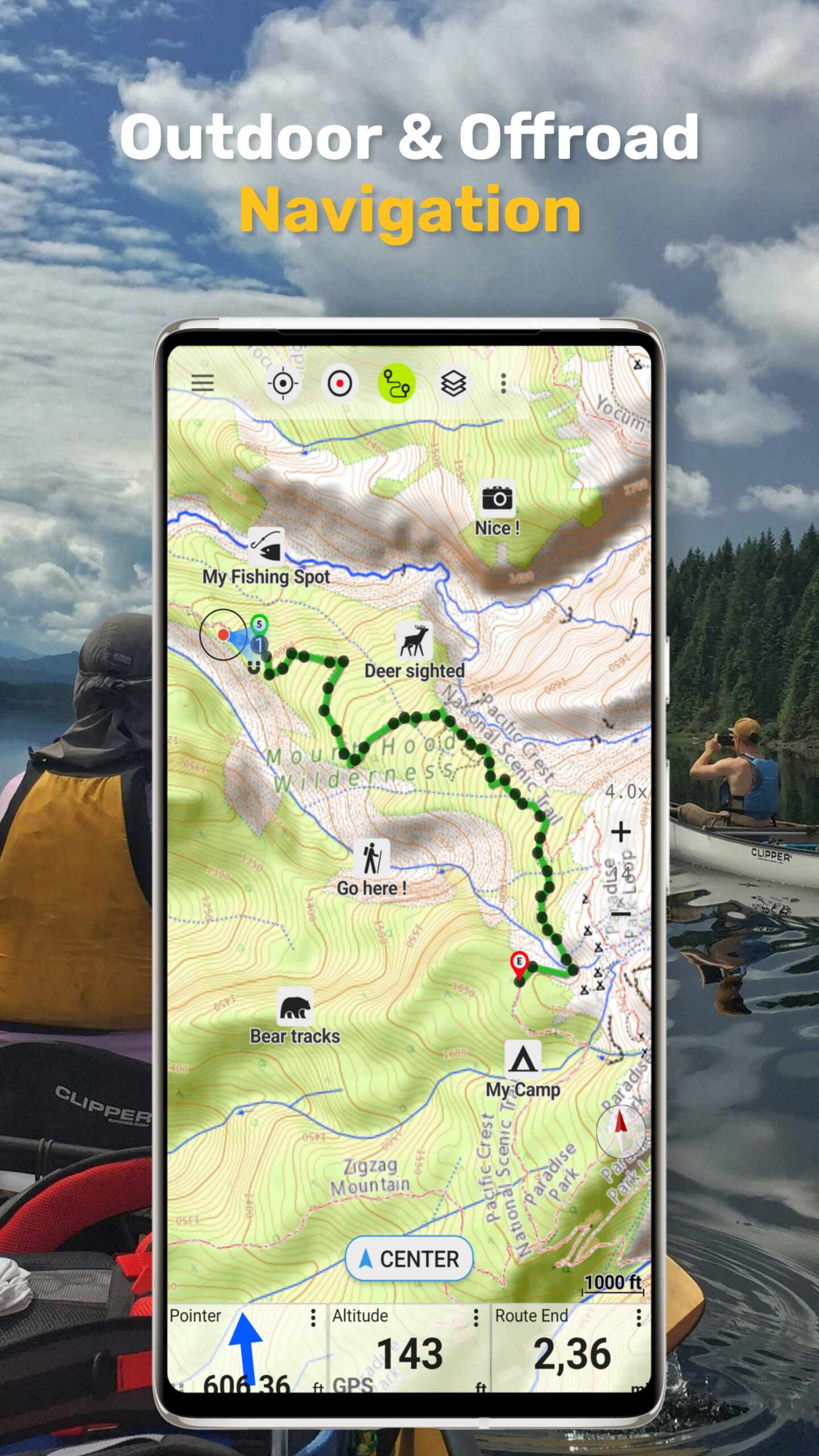
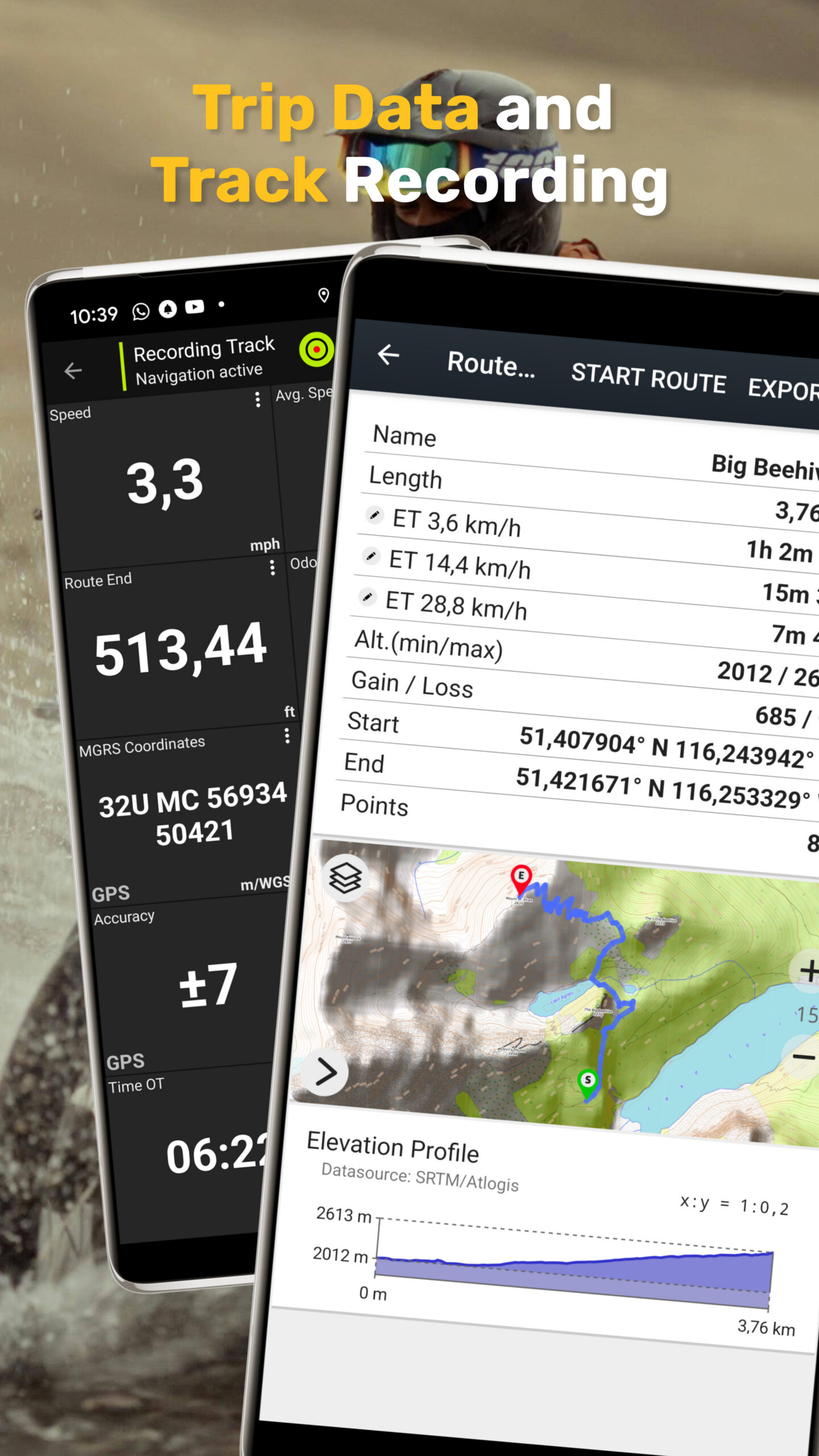
Outdoor GPS Navigation Features
Reliable navigation tools for outdoor use:
• Record GPS tracks with distance, speed, elevation, and accuracy
• Trip master with customizable data fields (speed, altitude, bearing, distance, etc.)
• Create and manage waypoints
• Go-to waypoint navigation
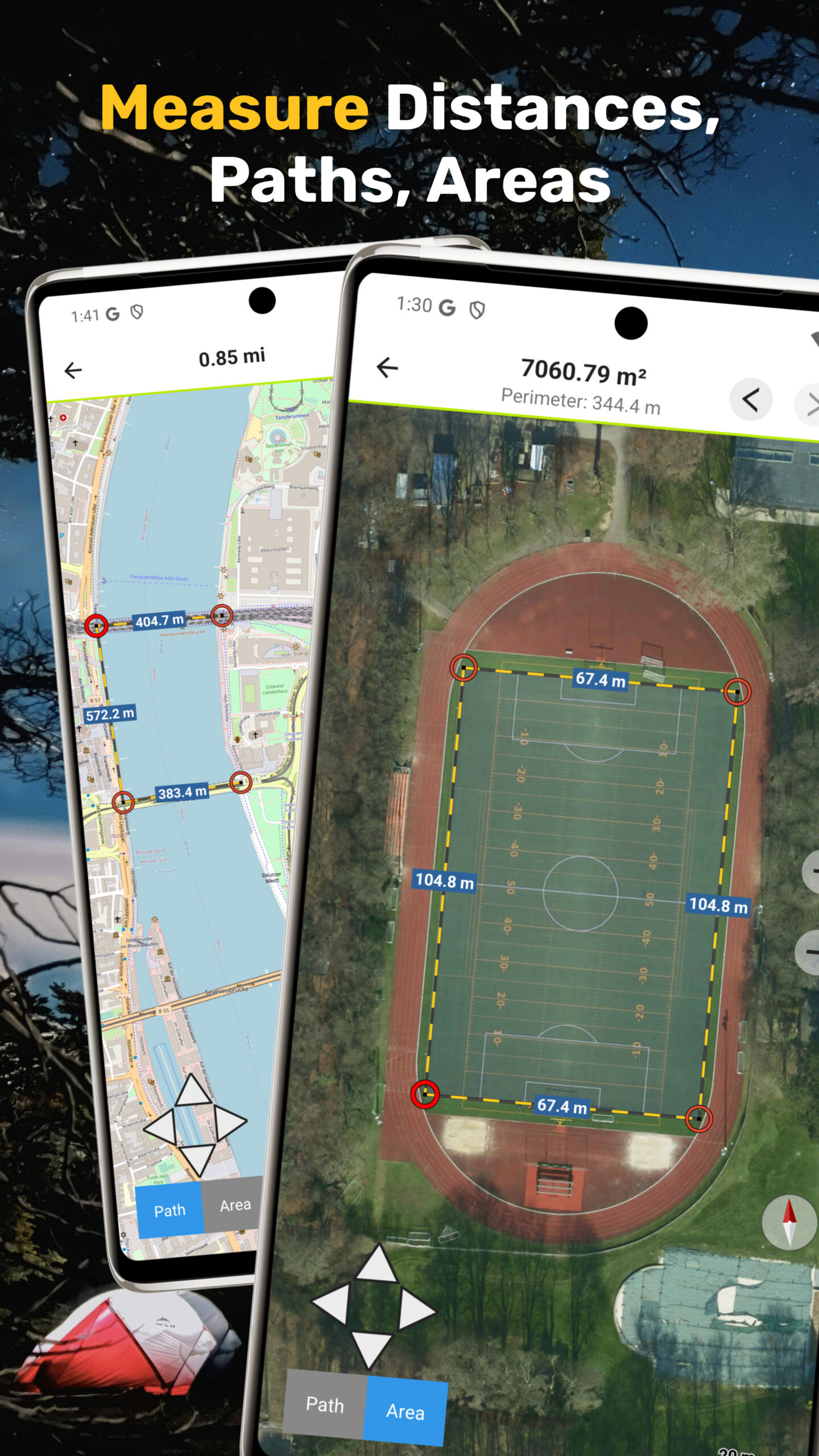
• Measure distances and areas
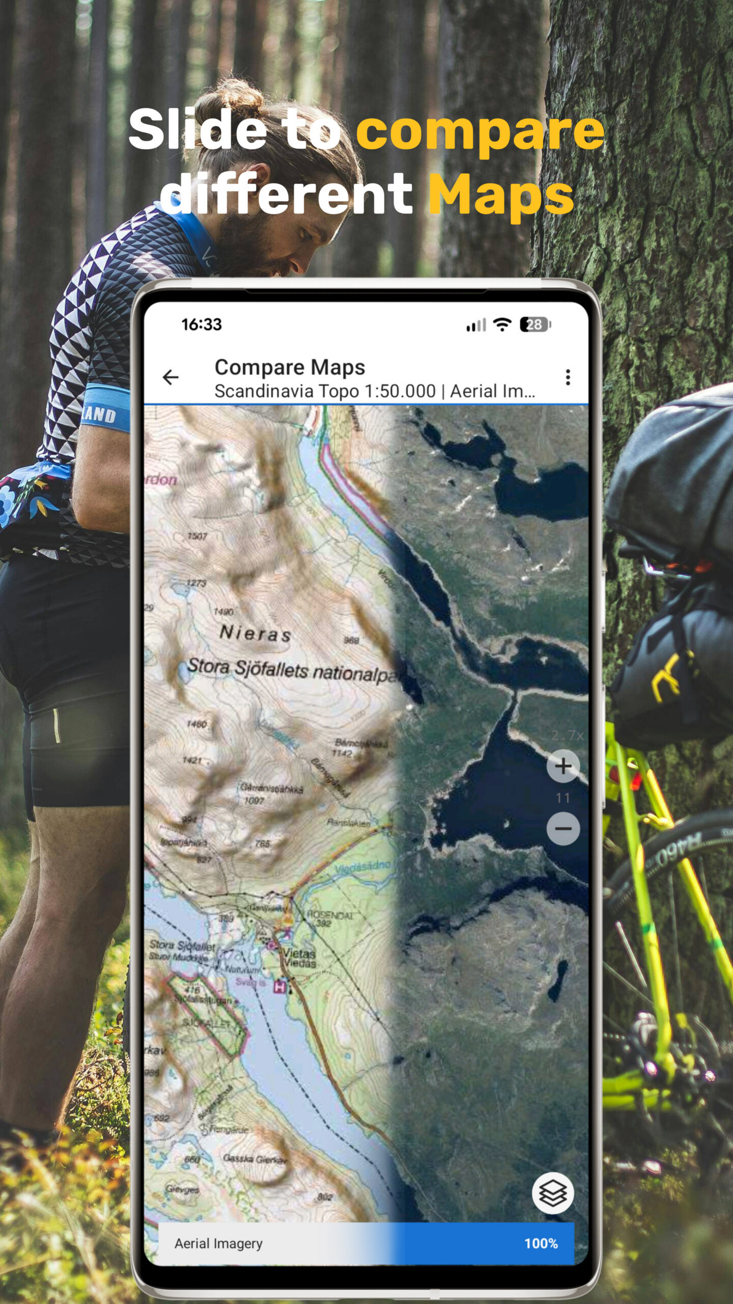
• Compare maps with transparency (fade between map layers)
• Search for places, addresses, and POIs
• Display coordinates in Lat/Lon, UTM, or MGRS/USNG
• Rotate map (North Up / Track Up)
• Get elevation and distance by tapping the map
• Track replay
• Export and share data (GPX, KML, KMZ)
Map Overlays (Free)
Enhance maps with additional layers:
• Hiking, cycling, MTB, and winter sports routes
• 10 m contour lines
• Hillshade overlay
• Open Hunting Permit Areas
• Managed Campsites
• Freedom Camping Restrictions
• DOC Huts
• DOC Tracks
• Taupo Trout Fishing District
Pro Features (In-App Purchase):
Unlock advanced offline navigation:
• Full offline GPS navigation without mobile signal
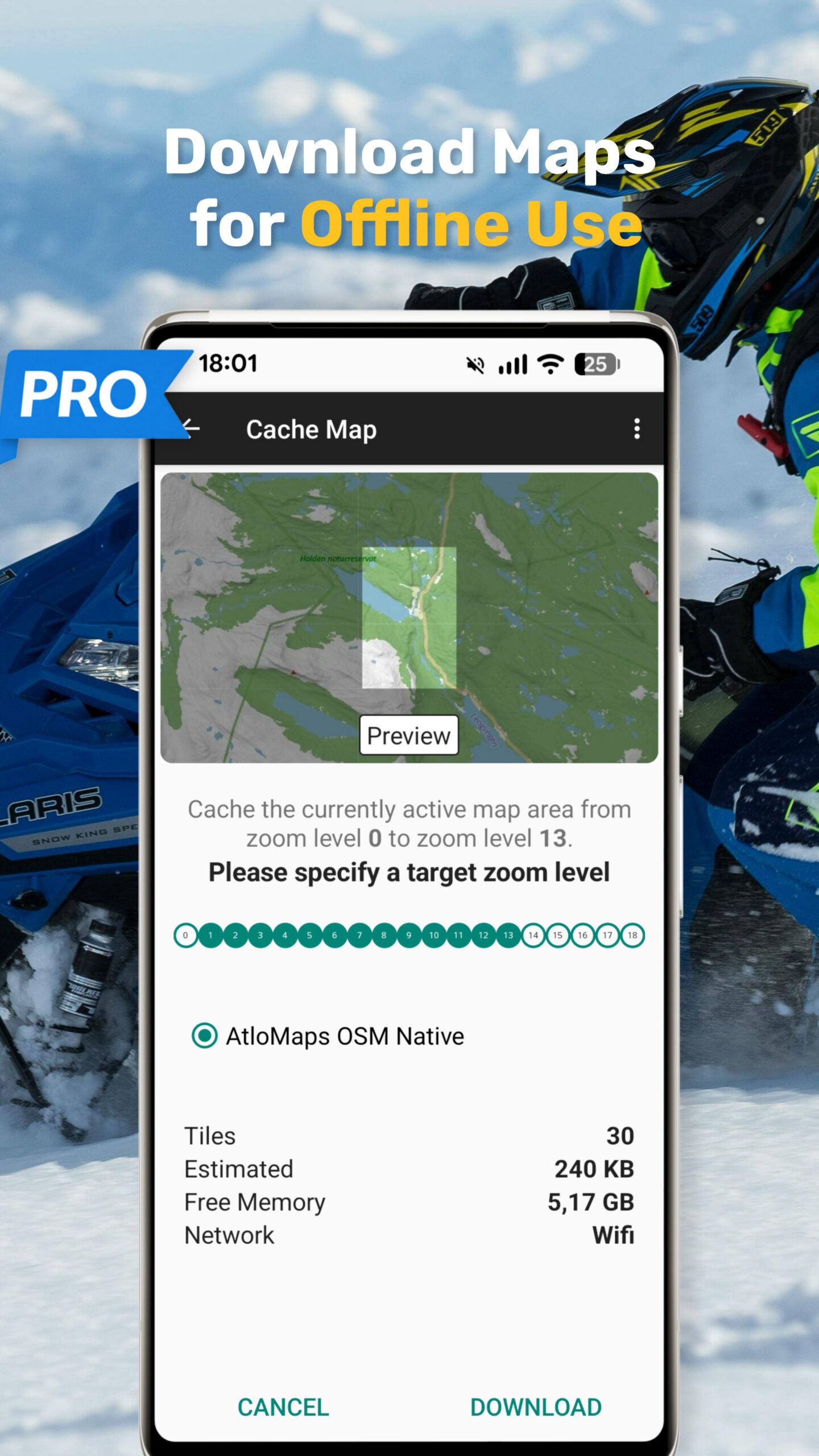
• Bulk download of maps for offline use
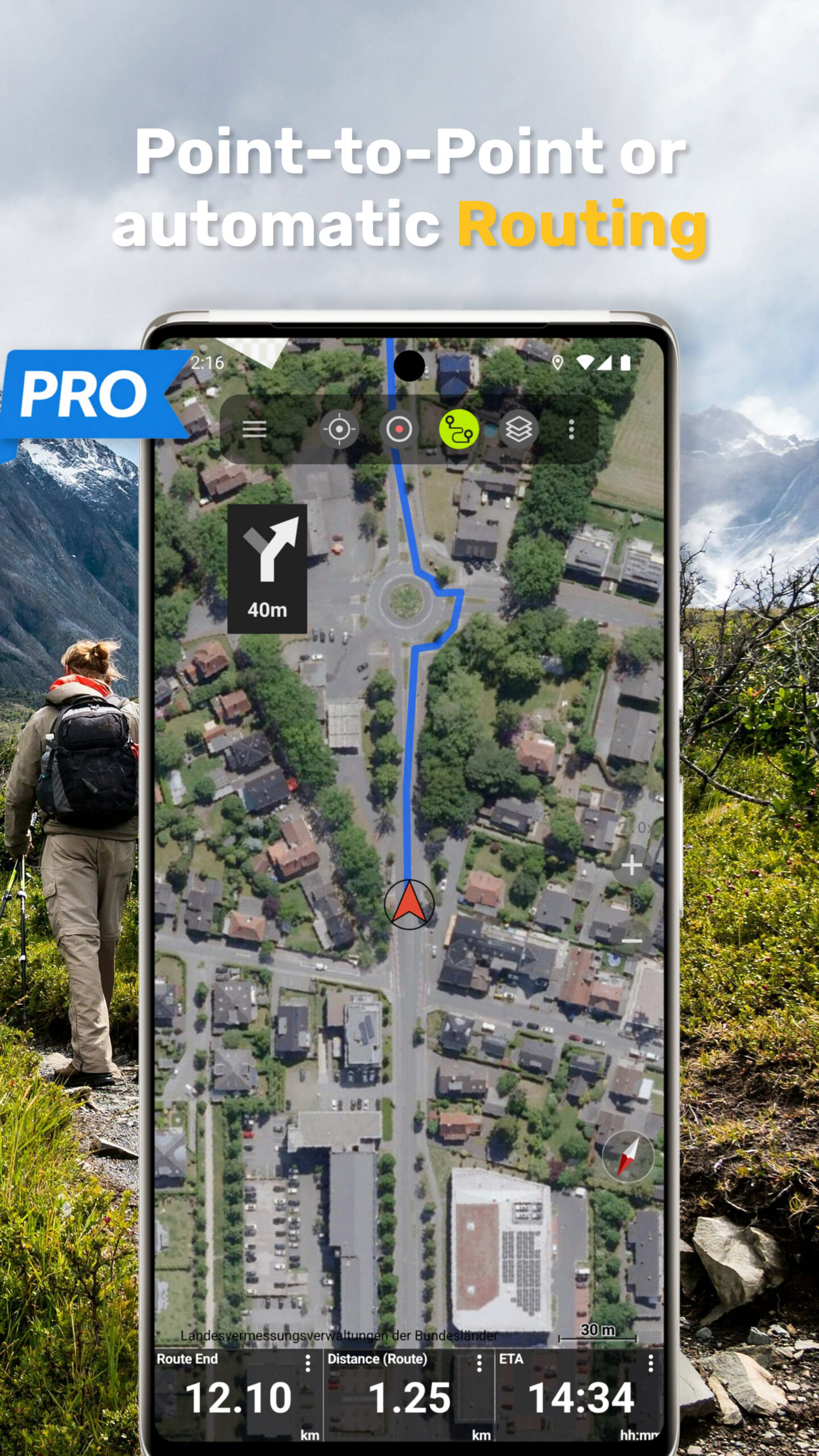
• Route navigation with automatic routing (hiking and cycling profiles)
• Create and edit routes
• Import GPX, KML, KMZ files
• Unlimited waypoints and tracks
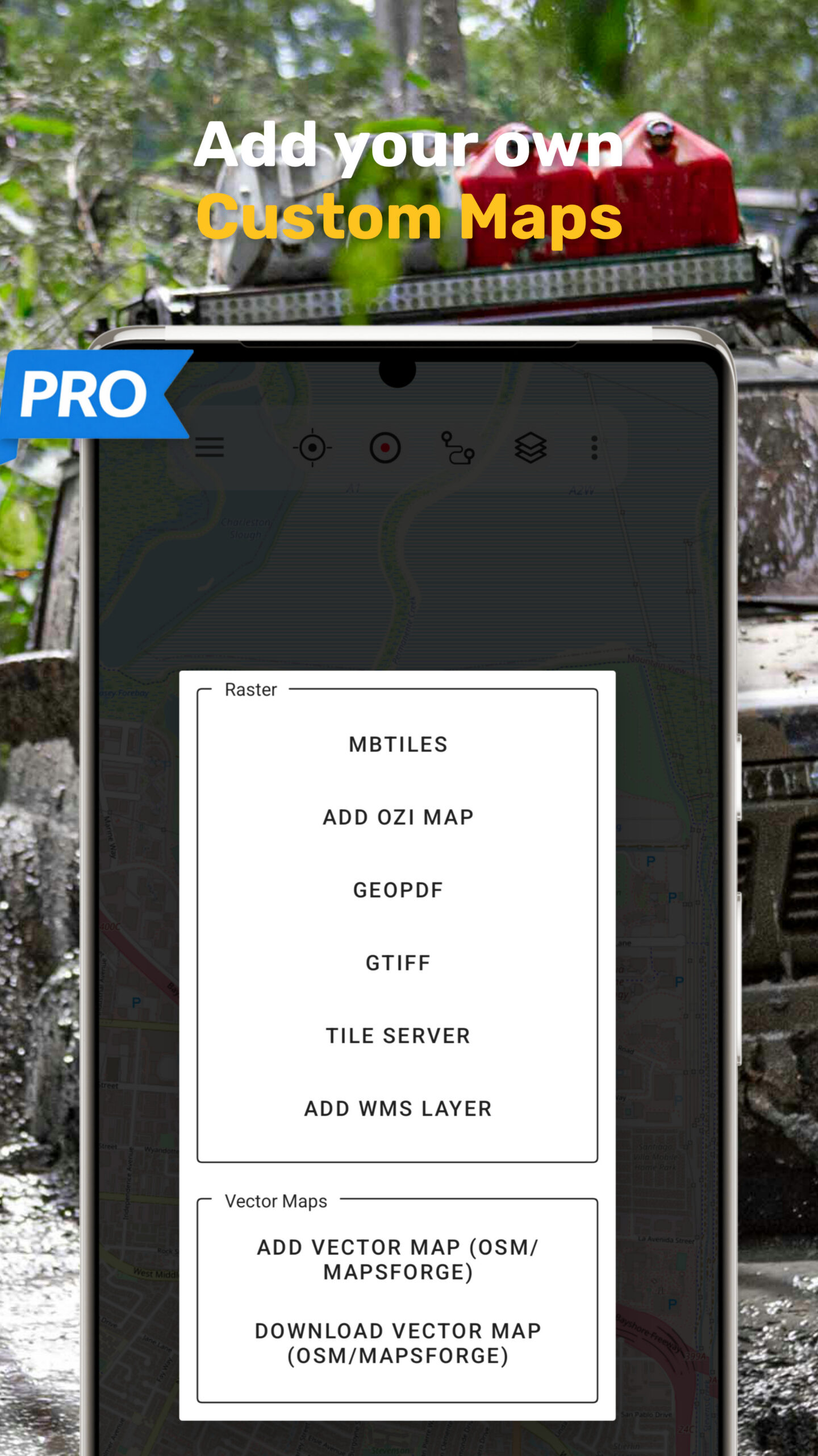
• Add custom map tile servers (WMS and raster maps)
• Add custom maps as GeoPDF, GeoTiff, MBTiles or OZI format
• No ads
Offline Maps and Navigation
All viewed map tiles are cached automatically.
Download larger areas in advance and use the app completely offline without roaming costs.
Outdoor Activities
Ideal for hiking, cycling, MTB, camping, skiing, climbing, canoeing, aviation, hunting, off-road navigation, and search and rescue (SAR).
GPS Data and Formats
Create and use waypoints in Lat/Lon, NZTM2000, UTM, or MGRS/USNG (WGS84).
Import, export, and share GPS data in GPX or Google Earth KML/KMZ format.
Privacy
No tracking. No data collection. Your location data stays on your device.
Support:
support@atlogis.com