
Norway Topo Maps
Outdoor GPS Navigation with topographic maps and aerial imagery for Norway
Turn your Android phone or tablet into a powerful offline GPS navigation system for Norway. Perfect for hiking, cycling, and outdoor activities in areas without mobile coverage.
Explore detailed topographic maps, aerial imagery, nautical charts and satellite maps with advanced navigation tools – similar to professional GPS devices.
Access high-quality maps for Norway and worldwide:
• Norway Topographic Maps from Kartverket
• Norway Nautical Charts from Kartverket
• Norway Historical Maps from Kartverket
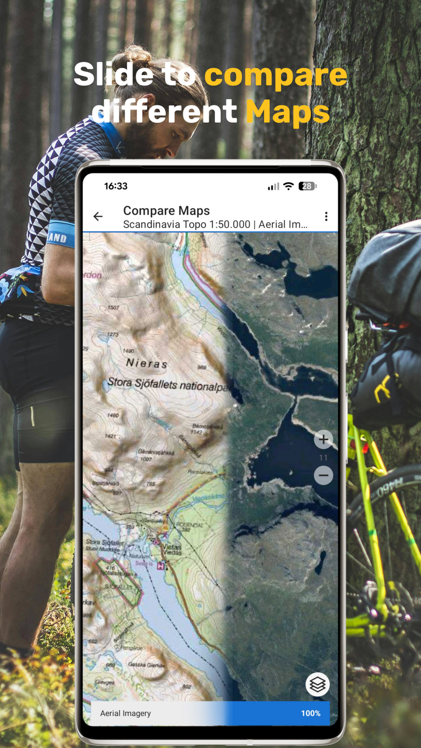
• 1:50,000 Topographic Maps for Scandinavia (Norway, Sweden, Finland, Denmark)
• AtloMaps OSM Maps with hillshading (worldwide)
• CyclOSM maps for cycling routes
• ESRI Topographic, Aerial, and Street Maps (online only)
• Google Maps and Satellite (online only)
• Bing Maps and Satellite (online only)
• Earth at Night
Outdoor GPS Navigation Features
Reliable navigation tools for outdoor use:
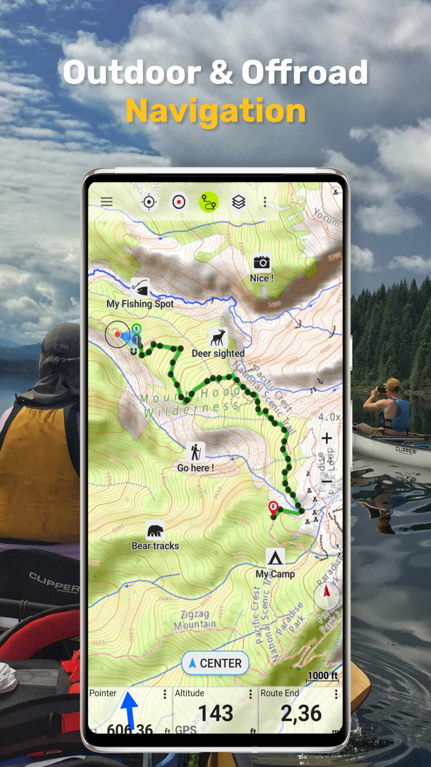
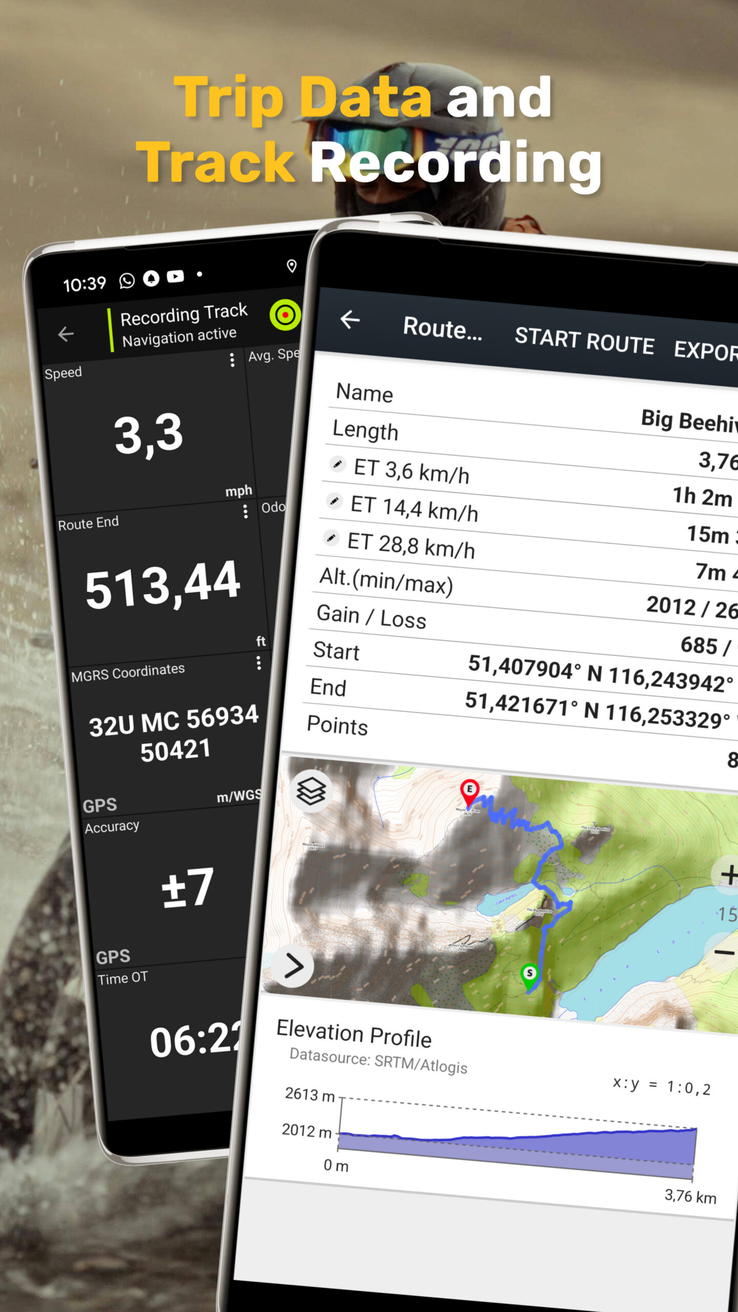
• Record GPS tracks (distance, speed, elevation, accuracy)
• Trip computer with customizable data fields
• Create and manage waypoints
• Navigate directly to waypoints
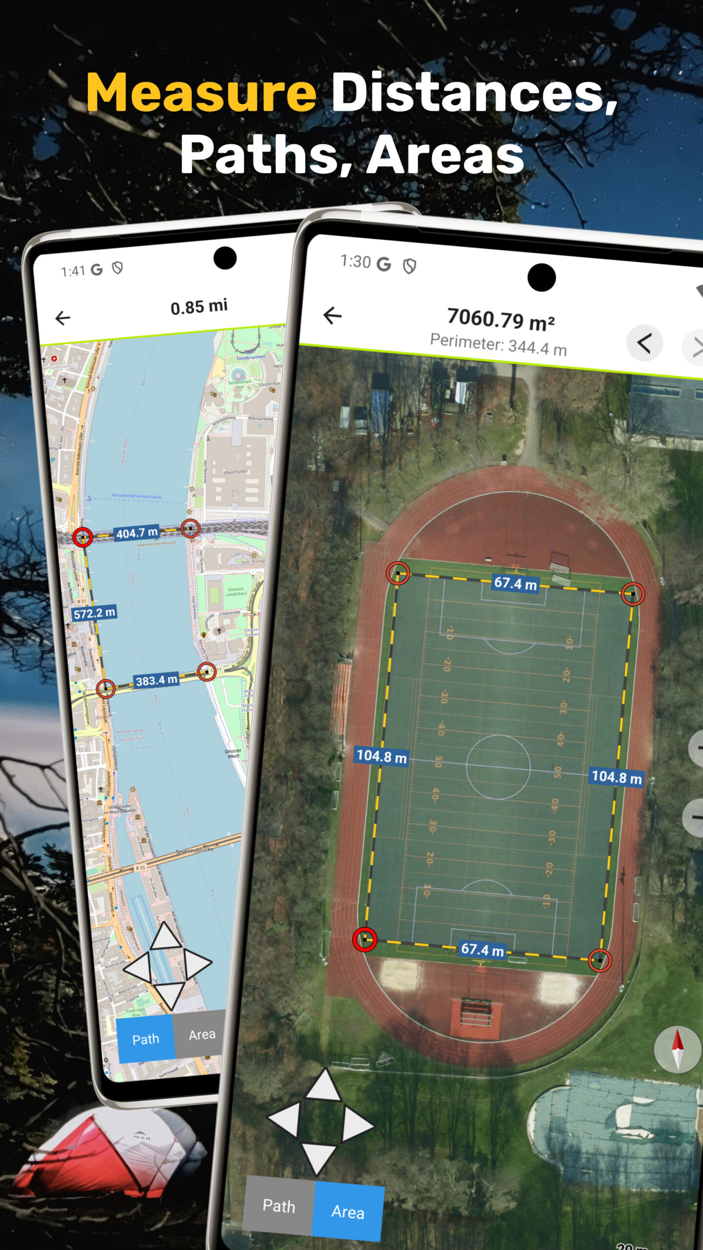
• Measure distances and areas
• Compare maps with a transparency slider
• Search for places, addresses, and POIs
• Display coordinates in Lat/Lon, UTM, or MGRS/USNG
• Rotate map (North Up / Track Up)
• Tap map for elevation and distance
• Track replay
• Export and share data (GPX, KML, KMZ)
Map Overlays (Free)
Enhance maps with additional layers:
• Hiking, cycling, MTB, and winter sports routes worldwide
• Norway trekking, bicycle, and cross-country skiing routes
• Avalanche steepness
• Cadastre
• Placenames
• 10 m contour lines worldwide
• Hillshade overlay worldwide
• OpenSeaMap
Pro Features (In-App Purchase):
Unlock advanced offline navigation:
• Full offline GPS navigation without mobile signal
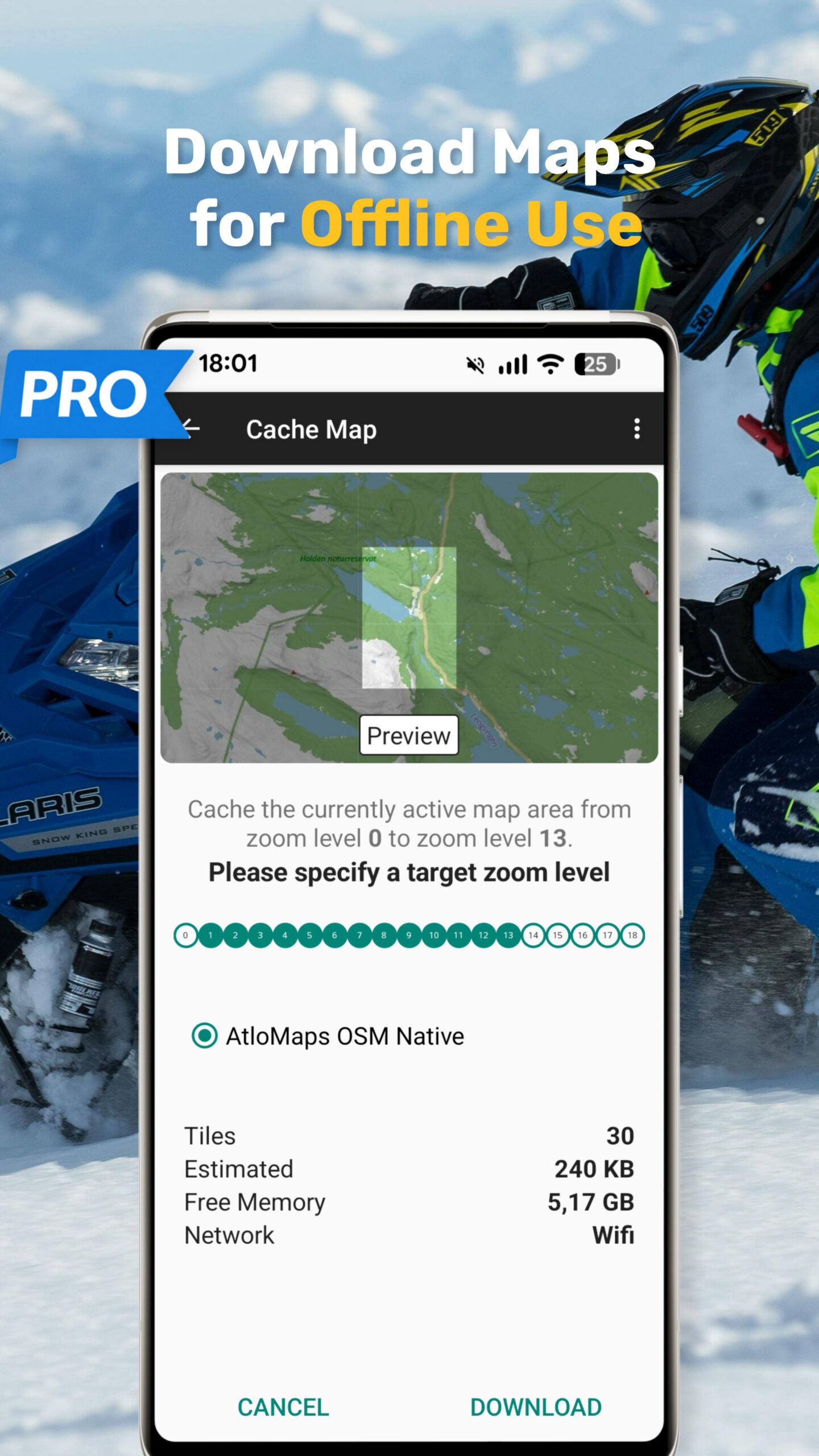
• Bulk download of maps
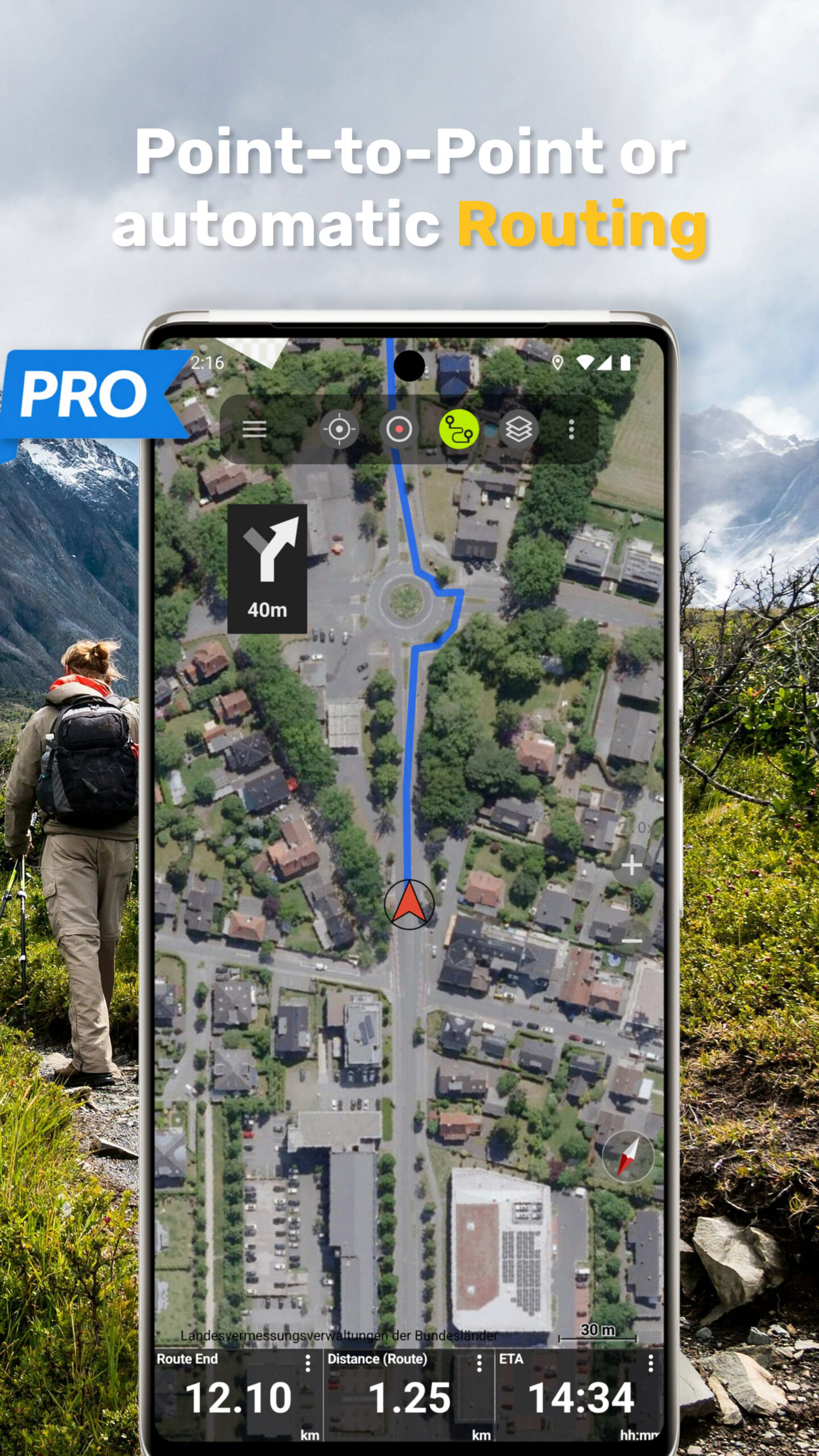
• Route navigation (hiking & cycling profiles)
• Create and edit routes
• Import GPX, KML, KMZ files
• Unlimited waypoints and tracks
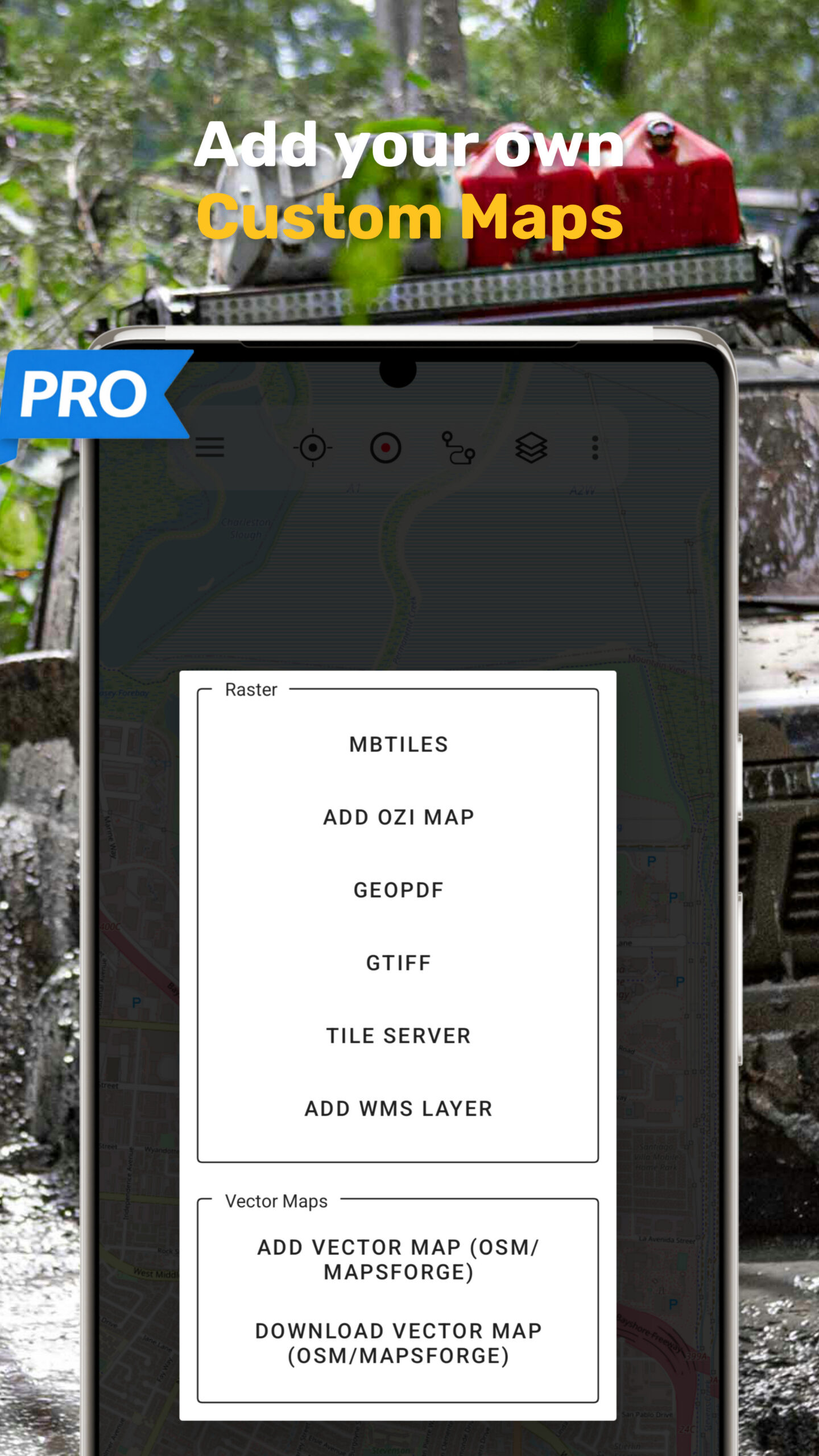
• Add custom map sources (WMS & raster maps)
• Ad-free experience
Offline Maps and Navigation
All viewed map tiles are cached automatically.
Download larger areas in advance and use the app fully offline – no roaming costs.
Outdoor Activities
Ideal for hiking, cycling, MTB, camping, skiing, climbing, canoeing, aviation, hunting, off-road navigation, and search & rescue (SAR).
GPS Data and Formats
Supports coordinates in Lat/Lon, UTM, and MGRS/USNG (WGS84).
Import, export, and share GPS data in GPX or KML/KMZ.
Privacy
No tracking. No data collection.
Your location data stays on your device.
Support:
support@atlogis.com