AtloMaps
Offline GPS Navigation & Topographic Maps with 300+ Maps
Access one of the most powerful mobile mapping and navigation platforms available.
With 300+ base maps and 100+ overlays, AtloMaps gives you unmatched control over how you explore and analyze the world — whether you’re a professional, outdoor enthusiast, or traveler in remote regions.
Discover far more detail than with standard map providers:
Many regional topographic maps reveal small trails, remote paths, terrain features, and waterways that are often missing in common maps.
In addition, high-resolution aerial imagery is available for many countries — and can be downloaded for offline use.
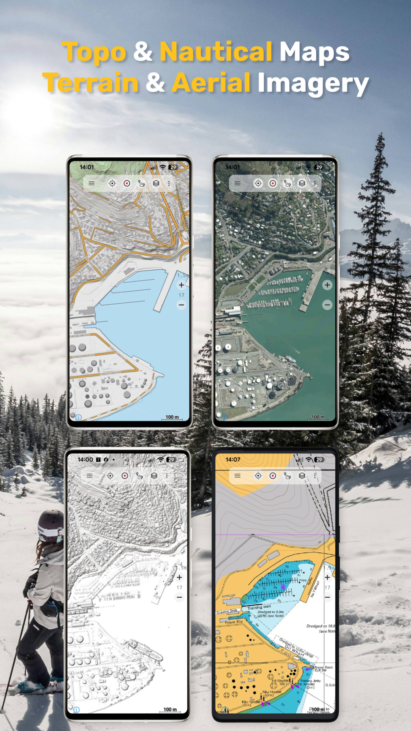
From high-detail topographic maps and aerial imagery to terrain models, historical maps, and nautical charts — everything in one app.
️ AtloMaps Base Layers
Our custom-built map layers provide a consistent, high-quality global mapping experience:
• AtloMaps OSM International – global map with Latinized labels
• AtloMaps OSM Native – map with local language labeling
• AtloMaps OSM Landcover – enriched with ESA landcover data
• AtloMaps OSM Physical – physical map with terrain relief and 10 m contour lines
• AtloMaps Hillshading v4 – high-resolution hillshading, in many regions based on LiDAR DEM data
Designed for maximum clarity, detail, and readability across all zoom levels.
Unmatched Map Variety
Explore an extensive collection of global and regional maps:
• Topographic maps from many countries
• OSM, Google, Bing and ESRI maps
• Specialized regional datasets
• Satellite & aerial imagery
• Terrain models & hillshade layers
• Landcover and physical maps
• Historical & military maps
Enhance maps with overlays:
• Hiking, cycling, and MTB routes
• Contour lines (elevation)
• Slope shading & terrain visualization
• Grid systems (UTM, MGRS, etc.)
• Many more thematic layers
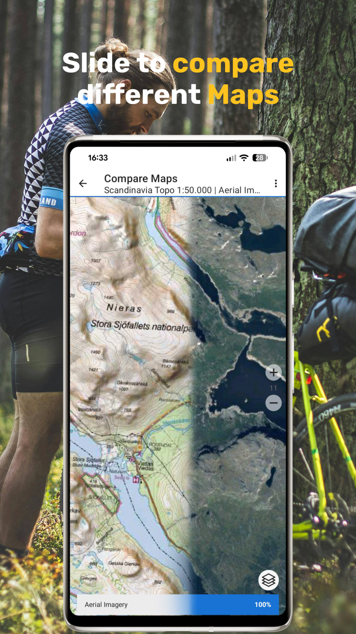
Compare maps with adjustable transparency and combine multiple layers.
This is not just a map viewer — it’s a complete mapping toolbox.
Advanced GPS Navigation & Tools
Professional-grade navigation features:
• Real-time GPS positioning with high accuracy
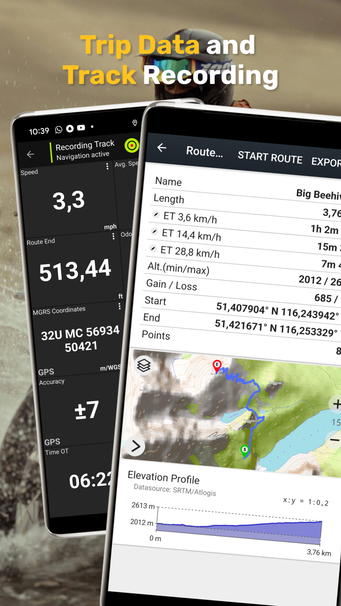
• Record tracks with distance, speed, elevation, and accuracy
• Trip computer with customizable data fields
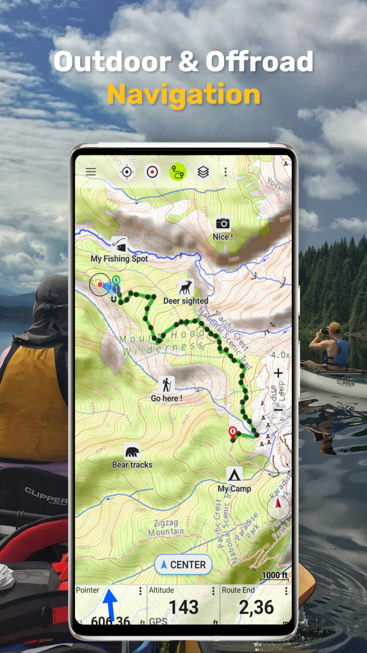
• Create, edit, and navigate to waypoints
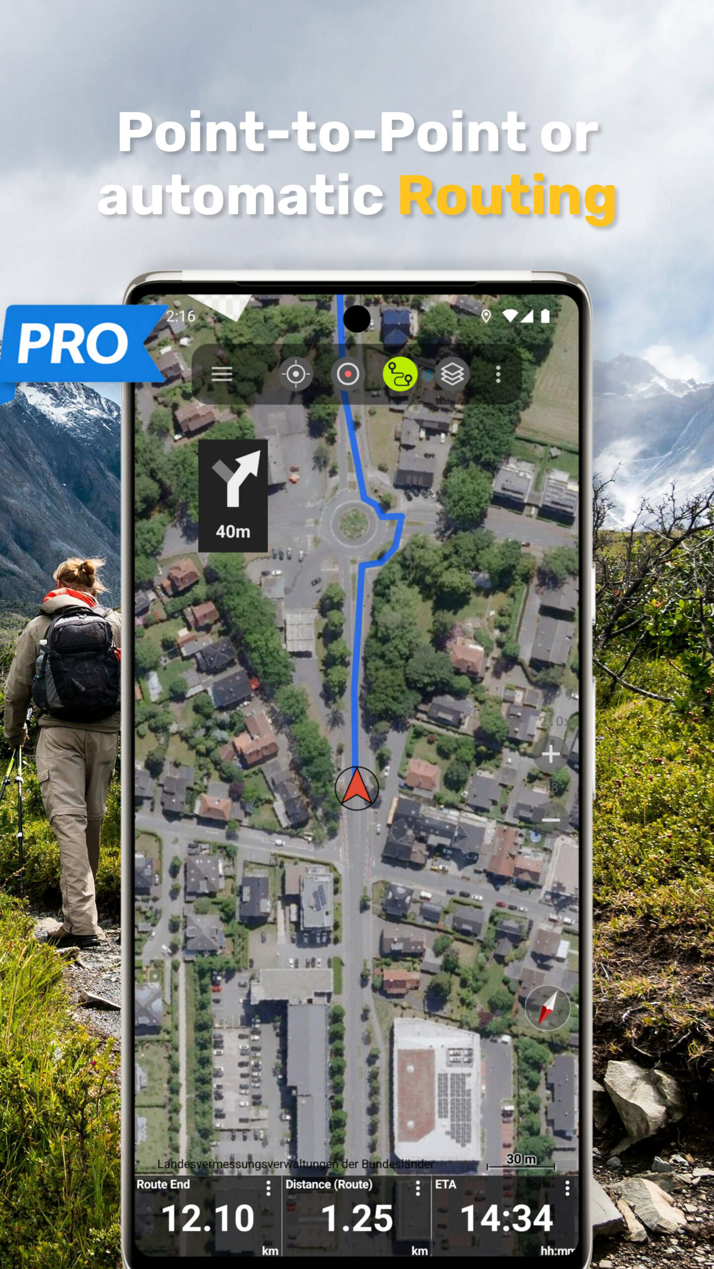
• Route planning and navigation
• GPX, KML, KMZ import & export
• Display coordinates in Lat/Lon, UTM, MGRS
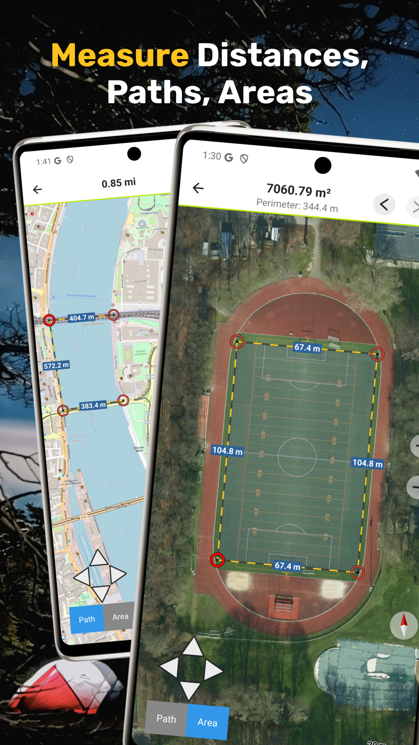
• Measure distance and areas
• Elevation profiles and tap-to-query
• Track replay and analysis
Reliable tools for anyone who depends on accurate location data.
Offline Maps & Navigation
Use the app anywhere — even without internet:
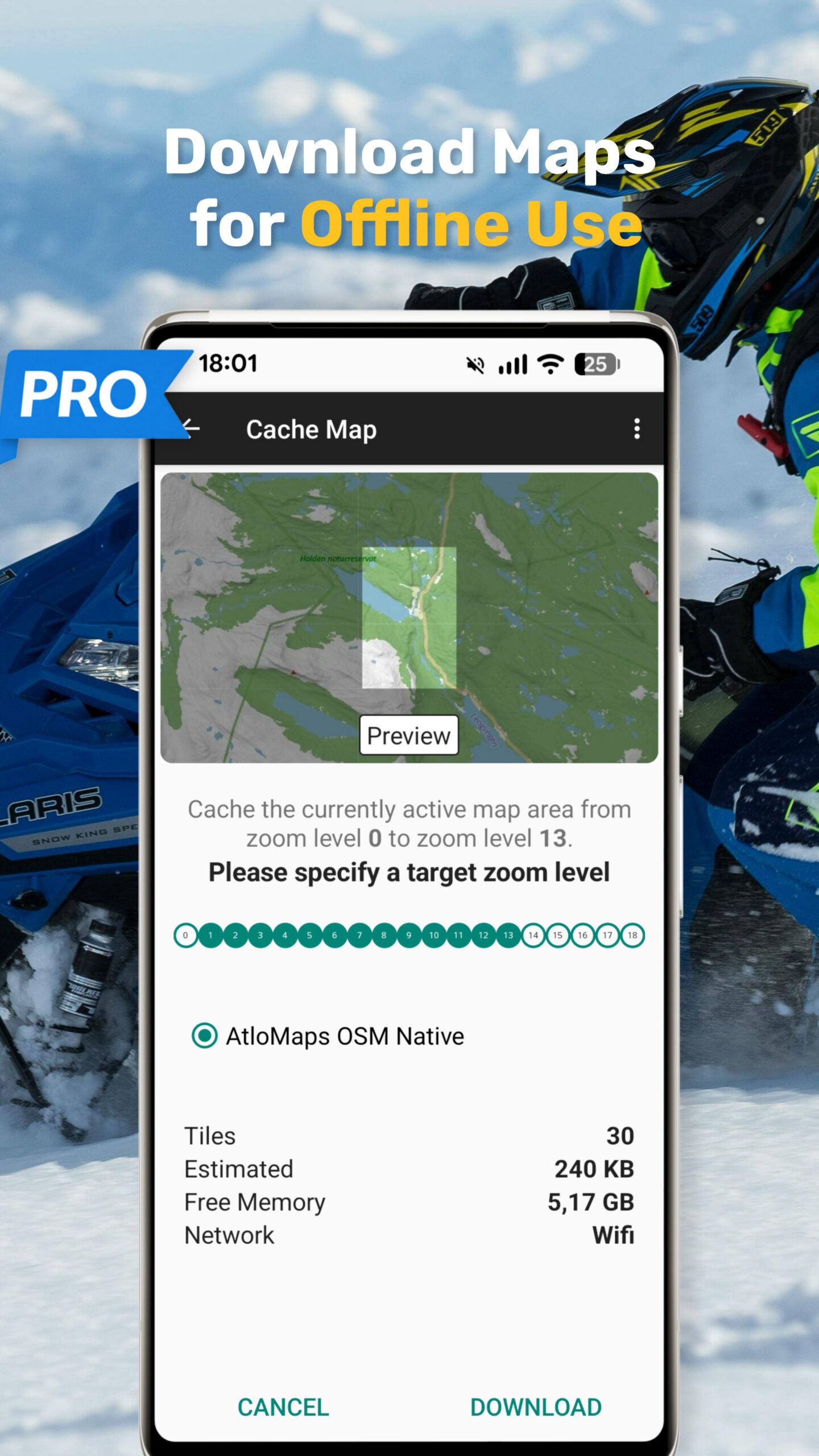
• Download maps for offline use
• Automatic tile caching for viewed areas
• Bulk download for large regions
• Full offline GPS navigation
Perfect for:
• Remote mountains, deserts, and forests
• International travel without roaming
• Expeditions, field work, and research
No signal? No problem.
⚙️ Advanced Mapping Features
Go beyond standard apps:
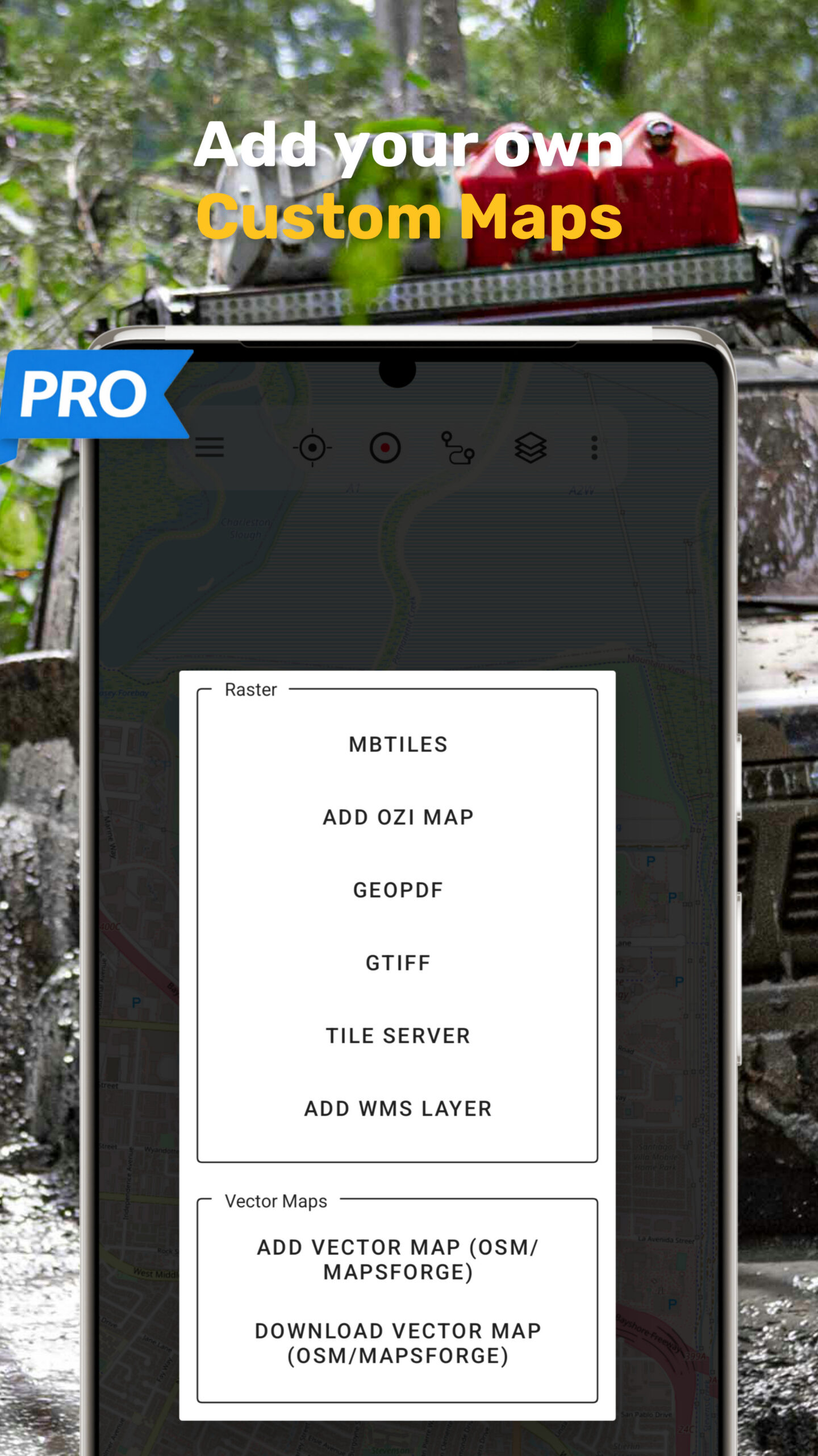
• Add custom map sources (WMS, tile servers)
• Import custom maps (GeoPDF, GeoTIFF, MBTiles, OZI)
• Support for multiple coordinate systems and projections
• High-performance map rendering
Designed for users who need full control over their map data.
Designed for Professionals & Adventurers
Ideal for:
• Travelers exploring remote regions
• Hikers & mountaineers
• Cyclists & overlanders
• Sailors & pilots
• Researchers & field workers
• Engineers & GIS professionals
If you care about map detail, projections, overlays, and data quality — this app is for you.
⭐ Pro Features
Upgrade to unlock:
•Turn-by-turn routing (hiking, cycling, etc.)
• Unlimited tracks & waypoints
• Ad-free experience
• Advanced export options
• Extended offline capabilities
Privacy First
Your data stays yours.
• No tracking
• No data selling
• Location data stays on your device
Trusted outdoor navigation apps — built by Atlogis since 2011.
If you have any questions don’t hesitate to ask support@atlogis.com