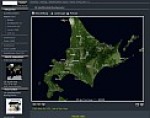
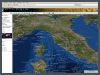
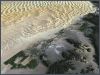
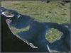
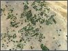
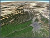
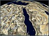
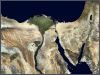
30 m GLOBAL SATELLITE IMAGE mosaic in simulated natural
color
More than 2000 predominantly cloudfree
scenes of NASA Landsat 5 satellite were extensively processed to
gain this seamless and color-balancedglobal
mosaic of the earth in realistic colors.
The satellite image mosaic with a resolution of 28.5
meters/pixels is particularly suited for various (Web-)GIS
and Navigation systems.
Additionally we offer the satellite image mosaic in 5 reduced resolutions
(120,
240, 480, 960 and 1920 meter/pixel) - optimal for highest
performance and continuous, stepless zooming.
This global satellite image mosaic was generated with our proprietary
algorithms and is exclusively only available at Atlogis.
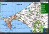
You can browse the complete 30 m satellite dataset on our Mapserver
online ! See for yourself the high quality of the data !
Specifications • Worldwide
seamless satellite image mosaic in natural color
• Nearly complete coverage of the land masses.
• Seamless mosaic from more than 2000 predominantly cloudfree NASA-Landsat
5-scenes
• Satellite imagery from 1990 - 1994
• Geographic Projection (Plate Caree), map datum WGS 84 (optional
also other projections)
• Resolution 0.000256 degree per pixel ( ca. 1 arcseconds or ca. 28.5
meters/pixel)
• Accuracy 50 Meter RMS (normally accuracy is better than 25 meters)
• More than 30 GB in ECW-format
• Available in 3878 2.25 degree-tiles or
regional single ECW-files (e.g. one ECW per country)
Format
The satellite image mosaic is divided into handy 2.25 degree tiles in
georeferenced ECW-format. On demand we provide the satellite image data
also in other graphical formats or projections. Also large countrywide
single ECW-files are possible.
Especially for GIS-Servers we offer the mosaic in tile-sizes of 256x256
or 512x512 pixels and additional reduced resolutions for different zoom-levels.
So the satallite imagery can be used directly by cache-based geobrowsers
like Google Earth/Maps or WorldWind.
Digital media • Navigation-Sytems
• Web-Applications • Geobrowser/GIS-Server •
Digital Atlases • Computergames • Flight Simulator
• Location based services
Television • 3D - Animations
• Edu-/Infotainment • Weather-Maps Printmedia
• Maps / Atlases • Poster / Large Format Print
• Press