Home Contact  
 
Satellite images 15m LANDSAT 7 mosaic 30m LANDSAT 5 mosaic 120 – 1920m Landsat 15m ASTER Satellite image maps
Digital maps Shaded relief maps World-vector-map-set
Products Atlo3D Atlomaps
Services GIS / Remote Sensing Web-GIS 3D Visualization GIS-Server/Data Hosting Large format printing (LFP)
Shop Atlogis Map Shop

Global SATELLITE IMAGE MOSAIC in 120 - 1920 meters/pixel resolution

For several uses it is enough to have medium or low resolution satellite images. Therefore we offer our Landsat 7 satellite image mosaic in 5 reduced resolutions with 120, 240, 480, 960 and 1920 meters per pixel .
Also these images can be used as upper zoom levels for our 15m- and 30m-mosaics.

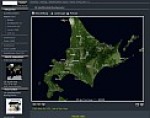
Please use the image viewer on top of this page to browse the 120 m satellite image or click on the example links below.


Specifications
World-wide satellite image mosaic in natural color

Resolution Pixelsize Pixels Size Tiff Size Ecw Ca. Scale Atlogis Maps
120 Meter/Pixel 361342x146490 Pixel 53 Giga-Pixel 147 GB 5.5 GB 1:216.281
240 Meter/Pixel 175788x78128 Pixel 13.7 Giga-Pixel 38 GB 1.2 GB 1:432.562
480 Meter/Pixel 98883x43948 Pixel 4.3 Giga-Pixel 12 GB 360 MB 1:865.124
960 Meter/Pixel 43948x21974 Pixel 965 Mega-Pixel 2 GB 95 MB 1:1.730.249
1920 Meter/Pixel 22584x9155 Pixel 206 Mega-Pixel 591 MB 25 MB 1:13.841.995


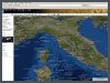
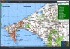
Clicking the links in upper table will open
Atlogis Maps and zoom to Las Vegas at the according scale to demonstrate the difference of the 5 resolutions.

Format
The satellite images are available as single, georeferenced ECW-files or as tiled JPEG-files.

Please contact us for further information.

Examples of use

Digital media
• Navigation-Sytems
• Web-Applications
• Geobrowser/GIS-Server
• Digital Atlases
• Computergames
• Flight Simulator
• Location based services
Television
• 3D - Animations
• Edu-/Infotainment
• Weather-Maps
Printmedia
• Maps / Atlases
• Poster / Large Format Print
• Press

GIS / Remote Sensing
• Cartography
• Surveying and Mapping
• Classification
• Scientific Visualization


Geo-Browser for our satellite imagery and maps.
Mapshop
We provide excellent satellite image mosaics and relief maps from any place on earth including height maps and vector data.

Geo-Browser for our satellite imagery and maps.
Landsat 7 v2 mosaic
Global satellite image in
natural color.

Topographic Maps
Topomapper
Browse world-wide
topographic maps.

» Print » Top » Back